What is Looking Ahead 2050?
Per Federal regulations, the Saint Cloud APO is responsible for planning and developing the overall transportation system for the Saint Cloud Metropolitan Planning Area (MPA). Working with state, regional, and local agencies staffed by land-use planners, environmental experts, civil engineers, and transportation professionals, the APO produces a plan that guides transportation-related development and prioritizes projects for at least the next 20 years.
This long-range, multimodal surface transportation plan is known as the Metropolitan Transportation Plan (MTP). Each MTP must include: an identification of existing transportation issues, projections of future transportation demand, and a long-term financial plan for funding the construction and preservation of the transportation network. From this, the APO develops a list of goals and objectives for the region including individual strategies, policies, and transportation projects to help achieve those goals and objectives.
The MTP must be updated every five years and is based on the community’s changing needs.
Looking Ahead 2050 is the APO’s latest update to the MTP.
Looking Ahead 2050 Visioning Themes
System and Environmental Stewardship
“Protecting and preserving our existing infrastructure and environmental assets.”
What We Heard
- “Fix the roads. They are terrible.”
- “Fix sidewalks.”
- “Better Roads.”
- “Repair bad roads and keep up with them.”
- “Reverse the effects of global warming.”
- “More availability of eco-friendly transportation.”
- “Cheap and clean fuel or energy.”
What Does the Data Say?
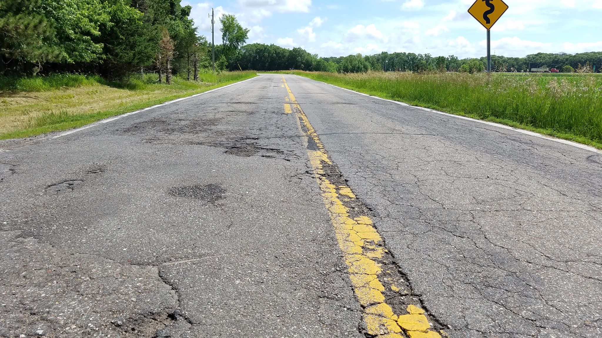
- There are approximately 2,555 miles of roadway within the planning area.
- About 50% of functionally classified roads (i.e., not local roads) are in good condition.
- Nearly 1 out of every 5 miles of functionally classified roadways are in poor condition.
- Forty-two out of 112 bridges in the planning area are in fair condition.
- Transportation is one of the leading causes of air pollution in the state.
Check Our Sources
- Goal 3 Section of the Saint Cloud APO’s 2020 Transportation Performance Monitoring Report (TPMR) (https://bit.ly/3idFMEG).
- Saint Cloud Area Planning Organization’s 2015-2019 Pavement Condition Report (https://bit.ly/3ilWv8X).
- 2020 Saint Cloud APO Shared-Use Path Pavement Condition Survey (https://bit.ly/3VDU8fX).
- Life and Breath: Greater Minnesota (2022) report (https://bit.ly/3UtaFCM).
- Greenhouse Gas Emissions Data (https://tabsoft.co/3UlrBe0).
Multimodal Connections
“Providing a safe and equitable multimodal transportation network affordable for people of all ages and abilities to travel using their preferred modal choice.”
What We Heard
- “Prioritize bicycle and pedestrian infrastructure.”
- “I would like to see more public transportation available in the region.”
- "More services for people with mobility issues.”
- “Transportation needs to be cheaper and more affordable to all.”
- “Gas needs to be less expensive.”
- "More and safer bike paths.”
- “Expanded public transit options.”
What Does the Data Say?
- There are just under 600 miles of active transportation infrastructure in the planning area (sidewalks, bike lanes, shared use paths).
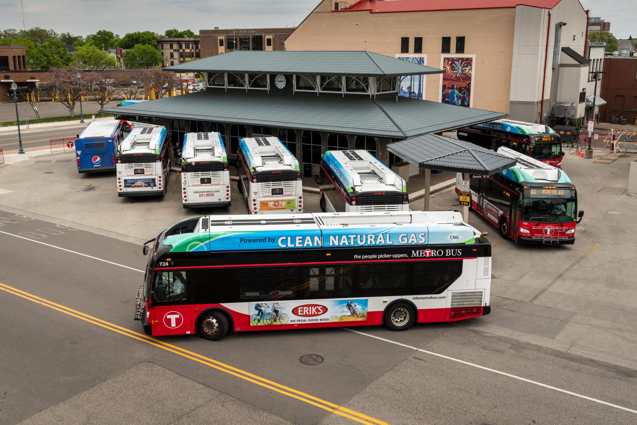
- Saint Cloud Metro Bus serves the communities of Saint Cloud, Sartell, Sauk Rapids, and Waite Park.
- Dial-a-Ride provided 152,239 rides in 2019 (the highest number of rides recorded in a 10-year period).
- The percentage of monthly household budgets spent on transportation throughout the region (broken out by the three counties – Benton, Sherburne, and Stearns) currently higher than the statewide average.
Check Our Sources
- 2022 Saint Cloud APO Regional Active Transportation Plan (https://bit.ly/3VmyrS4).
- 2020 Saint Cloud APO Shared-Use Path Pavement Condition Survey (https://bit.ly/3VDU8fX).
- Saint Cloud Area Planning Organization’s 2015-2019 Pavement Condition Report (https://bit.ly/3ilWv8X).
- 2016 Metro Bus Long Range Transit Plan Update (https://bit.ly/3AZg8Kn).
- 2021 Saint Cloud APO Regional Mobility Survey (https://bit.ly/3EUsUem).
- Goal 4 Section of the Saint Cloud APO’s 2020 Transportation Performance Monitoring Report (TPMR) (https://bit.ly/3idFMEG).
Congestion Management
“Mindfully planning, developing, and operating an innovative transportation network to minimize unnecessary travel delays.”

What We Heard
- “There needs to be a truck bypass rather than truck traffic clogging our city.”
- “Area needs a ring road or a bypass circling the St. Cloud metropolitan area.”
- “There is not a way to get east/west or north/south without going through St. Cloud or on I-94 that is a quick alternative.”
- “Our roads are congested.”
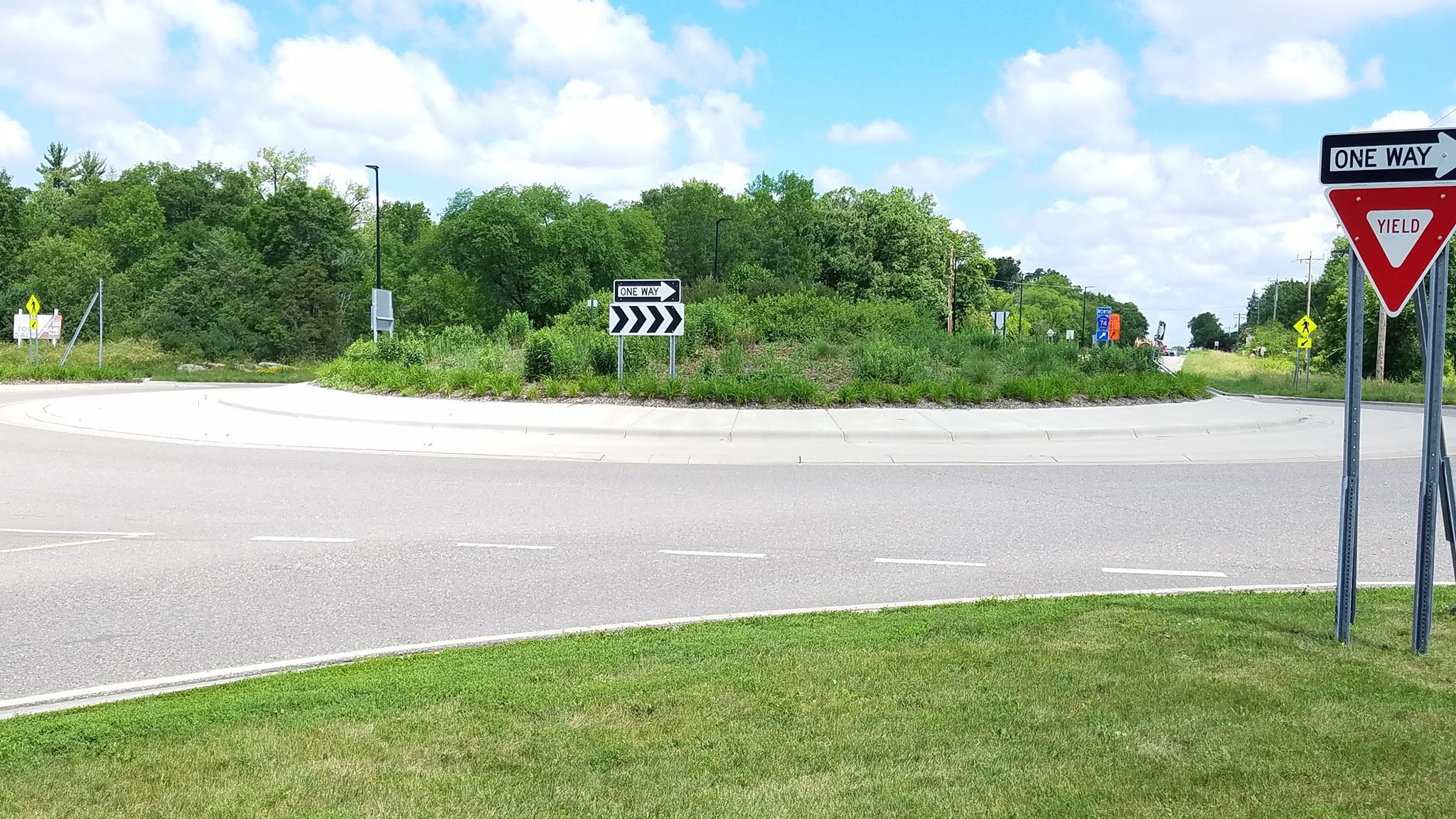
- “More roundabouts.”
- “Better timing of lights for better traffic flow.”
What Does the Data Say?
- Since the development of the last MTP, the APO has been exploring the various aspects of an urban beltline – including completing an alignment study for the Southwest Beltline portion (connecting Waite Park and Saint Joseph) as well as working to complete a study regarding the Mississippi River crossing at 33rd Street S.
- The APO is in the process of updating the Travel Demand Model (TDM) to estimate travel demands by 2050. More information is coming soon!!!
Check Our Sources
- Goal 2 Section of the Saint Cloud APO’s 2020 Transportation Performance Monitoring Report (TPMR) (https://bit.ly/3idFMEG).
- 2019 Saint Cloud APO Regional Freight Framework (https://bit.ly/3OOdPQ0).
- 2021 Saint Cloud APO Southwest Beltline Corridor Study (https://bit.ly/3ucrOpl).
- 2020 Saint Cloud APO Trunk Highway 15 Corridor Study (https://bit.ly/3ivAO6g).
- ONGOING Saint Cloud APO Mississippi River Bridge Planning Study (https://bit.ly/3uc5RqH).
- Urban Beltline Corridor Plans (circa 2005) (https://bit.ly/3ATv2Sz).
- City of Bloomington, Minn. “What is Signal Timing?” (https://bit.ly/3AXQINq).
Transportation Safety
“Reducing fatalities and serious injuries by planning, designing, and building safe infrastructure and improving driving behavior.”
What We Heard
- “Need better drivers.”
- “Speed control.”
- “Enforcement of traffic laws.”
- “Have safe intersections.”
- “Some better lighting in certain areas on the edge of the city.”
- “Stoplight enforcement.”
- “Current traffic control and enforcement needs to be managed better.”
What Does the Data Say?
- A vast majority of crashes within the MPA (76.5%) are property damage only crashes.
- Pedestrian-involved collisions (2016-2020) accounted for 0.8% of all crashes but account for 26.2% of all fatal crashes and 11.7% of all serious injury crashes.
- In 2020, the planning area reported 13 fatalities and 30 serious injuries.
- Statewide, male drivers ages 20-29 are involved in 14% of all fatal crashes but represent only 6.7% of the state’s population.
Check Our Sources
- Goal 1 Section of the Saint Cloud APO’s 2020 Transportation Performance Monitoring Report (TPMR) (https://bit.ly/3idFMEG).
- 2020 Minnesota Motor Vehicle Crash Facts Report (https://bit.ly/3XJfPNz).
Interregional Connections
“Supporting an economically vibrant region through developing and preserving vital connections to other state, national, and global centers of commerce.”
What We Heard
- “Easier travel to/from the cities.”
- “We need ways to get to the Twin Cities besides driving on I-94 and Highway 10.”
- “Rail transportation to the Twin Cities area.”
- “More times for light rail throughout the day to Minneapolis.”
- “We need better flow for truck traffic on the 94/10 corridor.”
- “More public transit options to get to/from Minneapolis.”
What Does the Data Say?
- Almost half of the working population living within the planning area works outside the Saint Cloud metro.
- Approximately 5.3% of the MPA workforce population lives in the seven-county Twin Cities metro.
- Between 2015 and 2019, those who commute more than 50 miles to work has grown by 13.4%.
- The top five employment industries for the region include: health care, retail, manufacturing, education, and food service.
Check Our Sources
- Goal 4 Section of the Saint Cloud APO’s 2020 Transportation Performance Monitoring Report (TPMR) (https://bit.ly/3idFMEG).
- 2021 Saint Cloud APO Regional Mobility Survey (https://bit.ly/3EUsUem).
- 2019 Saint Cloud APO Regional Freight Framework (https://bit.ly/3OOdPQ0).
- Saint Cloud Area Chamber of Commerce Major Employers (https://bit.ly/3H2A6b5).
- 2019 Where Workers are Employed (live in MPA).
- 2019 Where Workers Live (coming to MPA for work).
Technological Advancements
“Understanding and planning for future innovative transportation technologies and encouraging their presence and incorporation into the region’s existing transportation network.”
What We Heard
- “If electric vehicles are the future, then we need infrastructure for them.”
- “Prepare for autonomous transportation – autonomous taxi service.”
- “Our transportation system is in sort of a transition as we work to modernize and adapt it to address the needs of all users.”
- “More electric charging stations.”
- “Automated vehicles would be beneficial if affordable.”
What Does the Data Say?
- In 2020, there were 115 registered electric vehicles within the Saint Cloud metro.
- Approximately 95% of electric vehicles are charged at home.
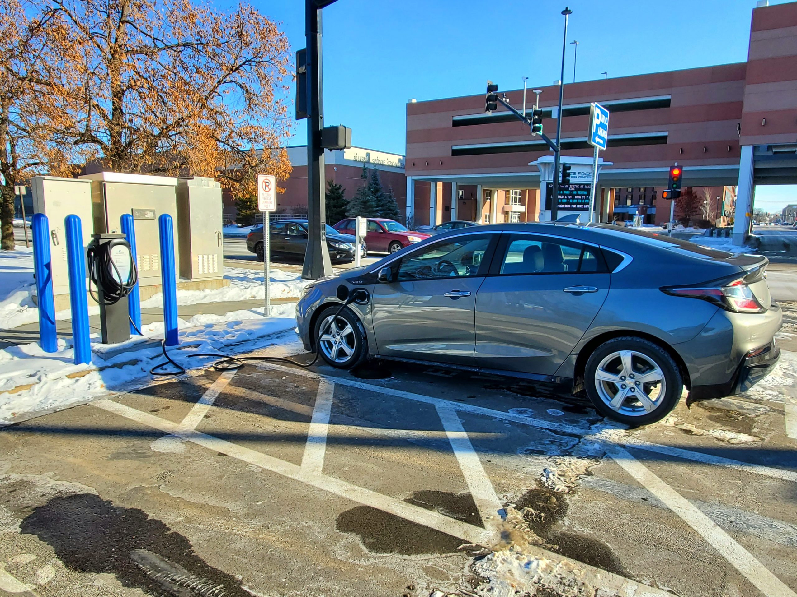
- As of 2022, there are currently eight public EV charging stations in the Saint Cloud metro. Two are located at Miller Nissan, four are located near River’s Edge Convention Center, and two are located at Riverside Park.
- MnDOT has designated I-94 as an alternative fuels corridor with the goal of promoting EV charging infrastructure across the state.
Check Our Sources
- Goal 5 Section of the Saint Cloud APO’s 2020 Transportation Performance Monitoring Report (TPMR) (https://bit.ly/3idFMEG).
- 2022 Minnesota Electric Vehicle Infrastructure Plan (https://bit.ly/3H2WS2G).
- MnDOT’s Connected and Automated Vehicles (http://www.dot.state.mn.us/automated/)
Where we are in the process
The APO approved the last MTP – MAPPING 2045 – in October 2019. Once that document was approved, the countdown to develop the next MTP started. Check here for the latest updates to the process. If you would like to be kept informed about Looking Ahead 2050 or other APO planning activities, please contact APO Senior Transportation Planner Vicki Johnson (ikeogu@stcloudapo.org; 320-252-7568; or 1040 County Road 4, St. Cloud, MN 56303).
Sept. 7, 2023: At the Aug. 10, 2023, Policy Board meeting, the APO’s Policy Board officially approved the Looking Ahead 2050 Visioning Themes. These visioning themes will be the guiding principles as APO staff work collaboratively with local agencies and jurisdictions to continue the plan’s development.
In addition, APO staff are in the process of seeking approval on two portions of the Looking Ahead 2050 document: the Existing Conditions and the Environmental sections.
One of the key components in the development of the MTP — or in any planning process really — is to understand the existing conditions. In order to move forward, we have to have a basic understanding of where we are currently. Over the past two years, APO staff have worked to update the region’s existing conditions from our previous planning base year (2015) to base year 2020. The Existing Conditions section provides a comprehensive overview of the region. Included in this are the following:
- Demographics. This section includes population trends and various population characteristics such as Black, Indigenous, and People of Color (BIPOC); foreign born individuals; limited English speakers; people with disabilities; income; home ownership; zero vehicle households; broadband access; educational attainment; and labor force participation.
- Land Use. This information is based on the 2020 socioeconomic information provided during the 2022 model calibration.
- Commuting/Travel. This includes information based on work and work commute trips as well as information about travel destinations as determined during the 2021 regional household travel survey.
- Time of Day. While the APO’s Travel Demand Model does not provide a time of day discernment, APO staff were able to extract some preliminary data from the regional household travel survey to help inform peak travel periods. In addition, this section also looks at seasonal (summer) travel impacts on the National Highway System (NHS).
- Existing Infrastructure. This section is further divided into roadways, urban transit, active transportation, other transportation options, and freight.
- This section includes information on functional classification, vehicle miles traveled, average annual daily traffic, and the Federally required performance measures (safety, pavement condition, bridge condition, and travel time reliability). There is also a brief discussion of the overall network’s Level of Service based on the 2023 Travel Demand Model calculations.
- Urban Transit. This section includes information about the Saint Cloud Metro Bus system. APO staff dived into ridership, revenue hours/miles, vehicle fleet characteristics, and transit performance measures. This includes a discussion about the impacts of COVID-19 on the transit system.
- Active Transportation. This component of the existing infrastructure section details the active transportation network – the on-road and off-road systems. APO staff also provided information on pavement condition and system usage.
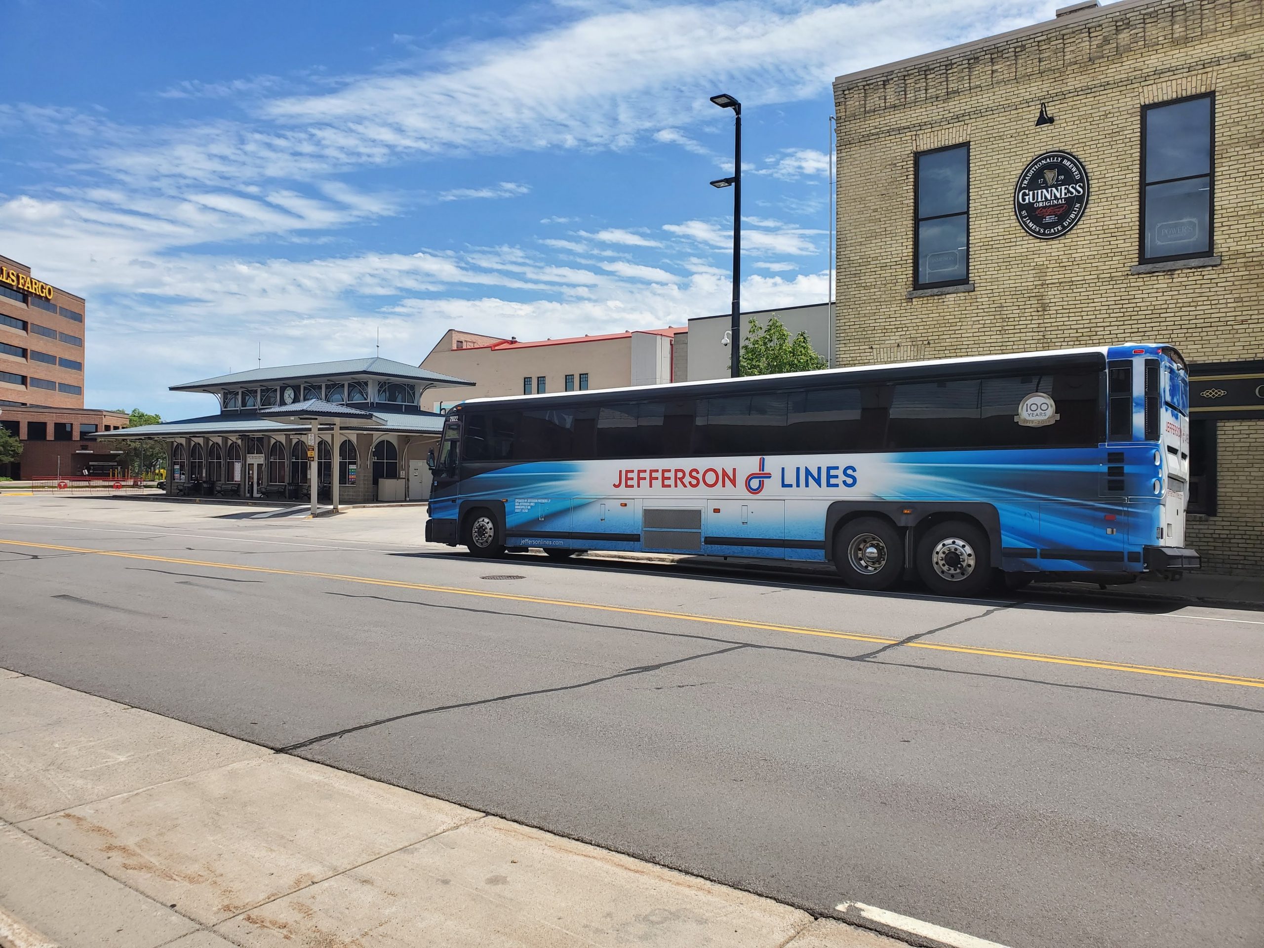
- Other Transportation Options. This includes a discussion on intraregional connections such as Uber/Lyft; taxi and limousine services; medical transportation service providers; and school bus transportation. Also discussed were the interregional connections including Tri-CAP, Saint Cloud Regional Airport Authority, Amtrak, Jefferson Lines, Northstar (both bus and rail), and Groome Transportation.
- This provided an overview of the Tier 1 (National Highway), Tier 2 (Minnesota Principal), and Tier 3 (Regional) Freight Networks as well as a brief discussion on rail and air freight transportation.
- Transportation and Economic Development. As part of this plan, APO staff hosted discussions with local and regional economic development experts on the significance of the surface transportation network. Experts provided insight into the benefits of transportation in attracting businesses and talent to the region as well as the impacts on the tourism aspect. These experts also provided a brief discussion on the shortcomings/struggles our existing network has when it comes to ensuring the continued growth of our regional economy.
The Environmental component of the MTP provides a comprehensive overview of the natural and physical environment. As part of federal regulations, the MTP must address the protection and enhancement of the environment, promote energy conservation, improve quality of life, improve the resiliency and reliability of the transportation system, and discuss various mitigation strategies and/or activities. Included in this section is a discussion of air quality, water quality, wildlife and habitat, soil health, and cultural and historic properties. Rounding out this chapter is a discussion on the impacts of climate change on the transportation network.
Both sections are anticipated to go before the APO’s Policy Board in Fall 2023.
Feb. 1, 2023: APO staff have just concluded a six-week public engagement opportunity about the proposed visioning themes for the development of Looking Ahead 2050. Over the next few weeks, APO staff will be reviewing all of the comments received as part of this outreach effort as well as finalize the existing conditions. Staff will then work to develop goals, objectives, strategies, and performance measures for the MTP.
Dec. 7, 2022: APO staff have launched the next round of public engagement on the development of Looking Ahead 2050. This process will conclude on Jan. 31, 2023. While this is occurring, APO staff will be working to finish up data collection as part of the existing conditions section of the 2050 MTP.
Oct. 17, 2022: APO staff are in the process of completing the existing conditions section of the 2050 MTP. This includes a comprehensive look at demographics (who lives here, where are they traveling, how are they traveling, and why) along with a detailed look at our existing surface transportation infrastructure. Staff are hopeful they will be able to wrap this task up by the end of October/beginning of November and be able to present their findings to the general public during another round of public input.
June 15, 2021: APO staff are in the process of conducting a regional visioning process to understand the regional transportation priorities our community members have. To do this, APO staff are asking people to share their transportation stories – the good, the bad, and what needs to improve. This process will conclude on Sept. 10.
In addition, APO staff are beginning to gather information on the existing conditions of the regional transportation network. This extensive data collection effort will rely heavily on the 2020 Census data along with other transportation data (i.e., traffic volumes, economic data, pavement and bridge condition, safety, etc.). A majority of this work will occur during the remainder of 2021 and will ideally conclude around the first quarter of 2022.
Finally, APO staff have been in the process of developing the APO’s first Regional Active Transportation Plan. Once completed, the recommendations from this plan will help guide the development of a robust network for bicyclists and pedestrians. APO staff anticipate releasing this document for public comment during the first quarter of 2022. For more information on the development of the Active Transportation Plan click HERE.
Nov. 18, 2021: Thank you to those who took part in our regional visioning process during the summer/fall of 2021. From now through the first quarter of 2022 APO staff will be reviewing these responses – along with those from our visioning question in the regional household travel survey – and developing transportation themes. Once these themes have been established, APO staff will be asking you to weight in (did we hear you correctly?) before solidifying our region’s transportation vision for 2050.
Looking Ahead 2050 consultant contract updates
While APO staff will be completing the bulk of the work in the development of Looking Ahead 2050, we will need to some technical assistance from consultants. If you would like to be kept informed about various consultant studies as they pertain to the MTP development, please contact APO Executive Director Brian Gibson (gibson@stcloudapo.org; 320-252-7568; or 1040 County Road 4, St. Cloud, MN 56303).
2020 Consultant Contracts
- Trunk Highway 15 Corridor Study: TH-15 between 2nd Street South and 12th Street North includes some of the most congested roadway in the region. Performance data also tells us that a significant number of crashes occur there too. This study evaluated the roadway for potential improvement strategies. You can see the final document HERE.
- Travel Demand Model updates and improvements: The APO maintains a complex computer model to forecast traffic under various conditions. Given the speed at which technology, computers, and modeling practice have evolved, our model was outdated in some respects. This effort sought to update and improve the model based on current best practices and proven technologies.
- Mississippi River Bridge Planning: An arterial beltline corridor surrounding the urban core has long been part of the APO’s long-range vision for transportation in the region. This study will examine the possibilities for connecting the intersection of 33rd Street South and Roosevelt Road in Saint Cloud to US-10 in Sherburne County, including a new bridge over the Mississippi River. The study is expected to be completed by the end of 2021. You can review the project web page HERE.
2021 Consultant Contracts
- Regional Household Travel Survey: In order to improve the predictive quality of our travel demand model, we need to know how people are moving around the region. This will be a random sample survey of households in order to develop an understanding of real-world travel behavior. That information can then be programmed into the computer model to calibrate it to real-world conditions. You can find the final presentation of results HERE.
- Southwest Beltway Corridor Study: An arterial beltline corridor surrounding the urban core has long been part of the APO’s long-range vision for transportation in the region. This study will examine the possibilities for constructing an arterial that connects the interchange at TH-15 and 33rd Street South in Saint Cloud to Highway 75 between Waite Park and Saint Joseph. You can find the final document HERE.
2022 Consultant Contracts
- 2022 Travel Demand Model Calibration & 2050 Population Forecast: The regional travel demand model (TDM) was recalibrated to more recent traffic counts, and was updated based on the TDM update effort in 2020 and the 2021 regional household travel survey. Additionally, population and jobs forecasts for 2050 were developed, which is the first step toward forecasting future traffic conditions.
- Opportunity Drive Study: A planning study for the Opportunity Drive corridor and the surrounding business park was completed. The smooth flow of freight and workers into and out of the business park is an important part of the economic competitiveness of the region. You can see the final plan HERE
- Mayhew Lake Road Study: A planning study for Mayhew Lake Road between MN-23 and 35th Street NE was completed. The corridor is beginning to experience some safety issues. The study will provide a vision for the corridor both now and into the future since the area is expected to experience very high development over the next 25 years. HERE
2023 Consultant Contracts
- Stearns CSAH 1 Corridor Study: The corridor (aka, River Ave North) between 9th Avenue and CR120 already experiences heavy traffic, which is likely to get worse over time. This study will examine the technical feasibility and public acceptance of potential improvements to increase safety and traffic flow efficiency.
- 2023 Metropolitan Transportation Plan Support: This contract is largely for traffic modeling assistance for potential future networks, and for the development of project cost estimates for potential future roadway (re-)construction projects.